Haikou City Natural Environment Introduction
Natural EnvironmentThe city of Haikou has a terrain that roughly resembles a heart shape, with a gentle slope and the longest river on Hainan Island, the Nan River, passing through the center. The northwest and southeast are higher, the center and along the Nan River are low and flat, and the north is mainly coastal plains. Except for Ma (222.8m) in Stone Mountain Town, (199.9m) in Old Town, (171m) in Jiashi Town and (168.3m) in Yongxing Town with 38 hills and ridges above 100m altitude, the vast majority are plateaus and plains with an altitude of less than 100m. Ma is the highest point in the city.
Geology Haikou's geological structure belongs to the south of the Rong's Gorge Fault Belt. The Wang Five – Wenchuang major fault to the north of the Middle Miocene and Upper Miocene in Hainan Island experienced faulting to the Straits of Qiongzhou, forming a continental and marine area of about 3135 square kilometers, accumulating a thick layer of Neogene (Third Period) strata, and then the Quaternary period, with multiple earthquakes and submarine volcanic activity, and multiple volcanic rock strata were distributed in the third and fourth periods. In the late Upper Miocene, the northern coast of the island uplifted, with several volcanic eruptions; after the Middle Quaternary, the north and northeast slowly subsided and accepted sediments. Haikou is located in the middle of the Neogene North China Fault Depression, mainly with the Neogene North China Fault Depression and the Northeast Ridge of Hainan Island (southeast), located in the composite area of regional east-west, north-south, northeast and northwest faults. The strata belong to the Neogene Early Jurassic (mainly) to the Quaternary period's coastal facies, marine facies and land facies. Volcanic rocks have sporadic outcrops of intrusive rocks and widespread distribution of basic and ultra basic volcanic rocks.
Terrain The terrain is divided into three parts: coastal plains, river terraces and hills and lava plateaus. The north is coastal plains, with low terrain and a vast area, accounting for 52% of the total area; the center is along the Nan River terrace area, accounting for 43% of the total area; the south-east is hilly and undulating, and the west is a lava plateau area, accounting for only 5%. The northwest and south-east are higher, the center along the Nan River is low and flat, and the north is mainly coastal plains. The surface is mainly distributed with quaternary volcanic rock and loose sediments, coastal with tidal platform terrain, and the west with typical volcanic landforms.
Soil The soil is divided into 8 types and 12 sub-types, 43 species, and 110 soil properties. These include rice soil, brick red soil, vegetable garden soil, tidal sand mud soil, coastal salt marsh soil, coastal salt soil, coastal sand soil, and stone soil.
Climate Haikou is located on the north-eastern fringe of the tropics, belonging to the tropical monsoon marine climate. The climate is warm and pleasant, with no long winters. Haikou's north coast, marine climate features are particularly significant, with warm and rainy, abundant sunshine, small temperature differences, long frost-free period and other marine climate characteristics. Affected by monsoon, rainfall concentrates in the period of 5-10 months, accounting for 81.9% of the annual rainfall, mainly tropical cyclones and convective rain (hot thunderstorms), with water heat synchronized. From November to April the next year is the dry season with less rain, often with spring drought. The main disaster weather includes typhoons, heavy rain, lightning, fog, strong wind, drought. The annual average temperature is 24.4℃, and the annual average maximum temperature is about 28.2℃, and the annual average minimum temperature is 18℃. The average monthly maximum temperature is 28.8℃, occurring in July; the average monthly minimum temperature is 18.0℃, occurring in January. The annual average rainfall is 1816mm, and the rainy days (rainfall ≥0.1mm) are 102 days. The annual average sunshine hours are 1954.7 hours. The annual average evaporation amount is 1834mm, the average relative humidity is 85%. The main winds are northeast wind and southeast wind, with an annual average wind speed of 3.4m/s.
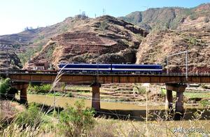
Hydrology Haikou's self-produced water resources total 19.07 billion cubic meters. The total water resources are equivalent to 830mm of surface runoff depth. The longest river on Hainan Island, the Nan River, flows through Haikou city's center into the sea. The mainstream of the Nan River is 75km long in the west of Stone Mountain Town, passing through the center of Haikou and flowing into the sea at the north-eastern part, and the estuary is divided into four main rivers: Hedian River, Hengou River, Tanlu River, Maiya River and Dao Meng River. The tributaries are: Tie Lu River, Thirty-Six Curves River, Duck Tail River, Chang Wang River, Meixie River and Xiang Shui River; 18 rivers flow directly into the sea. The reservoirs include: Feng Tan, Tie Lu, Dong Hu, Feng Zhou, Yun Long, Ding Rong, Ling Bei, Yu Feng, Sha Po and other reservoirs with a total storage capacity of 1.5 billion cubic meters. Haikou is located in the lower reaches of the Nan River estuary and the dormant volcanic crater area, with widespread shallow water and compressed water distribution. The underground water is located in the 4605 square kilometers of the North China self-flow basin. There are 10 layers with water in the 980m depth, with a water structure of 2 layers of shallow water, 1 layer of semi-confined water, and 7 layers of confined water. The shallow water layer is mainly the shallow water and hydrothermal fissure water of the Nan River delta and ultra basic volcanic rock, with a distribution area of 813.7 square kilometers, with an average flow rate of 20-8460 cubic meters/day*meter, and an allowable extraction volume of 212,000 cubic meters/day. The compressed water is in the Rong's Gorge basin, with a total thickness of up to 200-350m, with a total extractable volume of 270,000 cubic meters/day. The old Haikou and Xu Ying sections can be extracted for 270,000 cubic meters/day. The hot spring water is located in the northeast of the North China self-flow basin, in the Quaternary thick layer, with a distribution area of about 200 square kilometers.
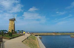
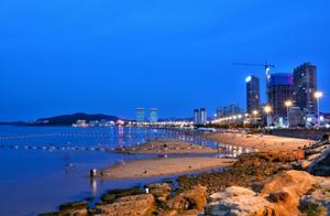
Sea Area Haikou's sea area to the north is 830 square kilometers, and the coastline is 136.23 kilometers. The average sea water temperature is 25℃, the maximum is 34℃, and the minimum is 17.2℃. The transparency is 1 meter, the maximum is 2 meters. The shallow sea and beach terrain area above 10 meters line is more than 100 square kilometers. Most of the seabed is gentle, mainly soft mud, followed by sand. Near the sand beach, the seabed is mainly fine sand. The near-sea water is rich in organic matter and inorganic salts. The water depth of 60-100m is about 200 square kilometers, and the shallow sea and beach terrain area with a depth of no more than 10 meters is more than 100 square kilometers. Most of the coastline slope is gentle, the coastline is wide and continuous, the sand beach is white and fine, there are weekend beaches, West Xiu Beach, Yuehai Railway Channel South Station Pier Beach, Bai Sha Men Beach, Dongzai Gang Pier Beach, Gui Lin Yang Beach and other coastal scenic areas and playgrounds. The bays and nearby islands have a few reefs and tidal flats. The near-sea water is clear, with little wind and waves, and there are several areas suitable for swimming.