How ‘Difficult’ is the Sichuan-Tibet South Line?


As soon as you mention the Sichuan-Tibet Highway, regardless of whether you’ve personally traveled it, people will likely share a common consensus: ‘It’s a travel enthusiast’s dream road.’ This is not an exaggeration, as the Sichuan-Tibet Highway is renowned for its breathtakingly scenic and perilous terrain, and the unique Tibetan culture adds to its mystique, making it a ‘level-up’ destination for travelers. After all, who would honestly admit that a traveler who hasn’t been on the Sichuan-Tibet Highway has a rich travel experience?
In reality, when people often refer to the ‘Sichuan-Tibet Highway,’ they are referring to the Sichuan-Tibetan South Line, which is the best-paved and shortest of the three Sichuan-Tibetan Highways (along with the North and Central lines), and a key component of National Highway 318. Therefore, this route is frequently mentioned as the preferred route for travelers entering Tibet.
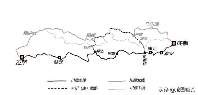
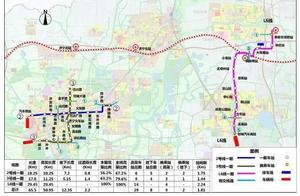
Sichuan-Tibetan Highway route map

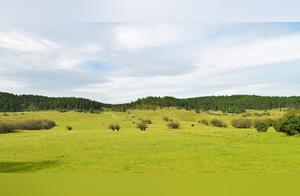
Young Qinghai and ancient Sichuan Basin are closely connected. The southeastern Tibetan Plateau’s Transversal Mountain Range boasts several long, high, and jagged mountain ridges, as well as deep, mysterious, winding canyons. At the summit, clouds and mist often swirl, and snowstorms rage, while at times the sky is clear and the sun shines on snow-capped peaks; in the canyons, some areas are bathed in sunlight with sparse vegetation, while others experience abundant rainfall with vast expanses of forests.
This group of mountains, rising from the basin’s edge, is like a series of long walls stretching across north and south; in the eyes of the past generations, the difficulty of crossing them was comparable to ascending to heaven.
It wasn’t until the modern, transformative period, when central dynasties first initiated plans to clear these southwestern sky-threatening obstacles in order to better manage the Sichuan region and consolidate control over Tibet, that the idea of building a road across these areas gained traction. From the late Qing Dynasty to the 21st century, a clearer road gradually emerged from the canyons, leading to the passes and increasingly facilitating communication between Chengdu and Lhasa.
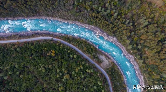
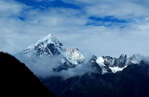
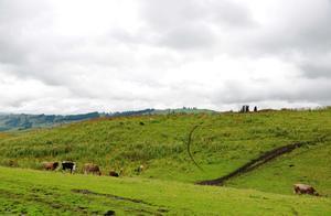
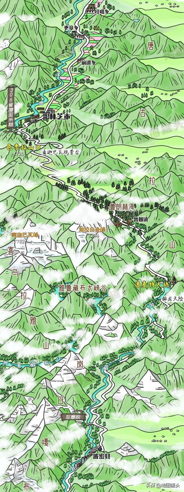
The National Highway 318 running parallel to the Palong Tsangpo River
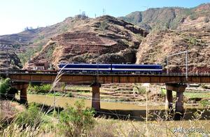
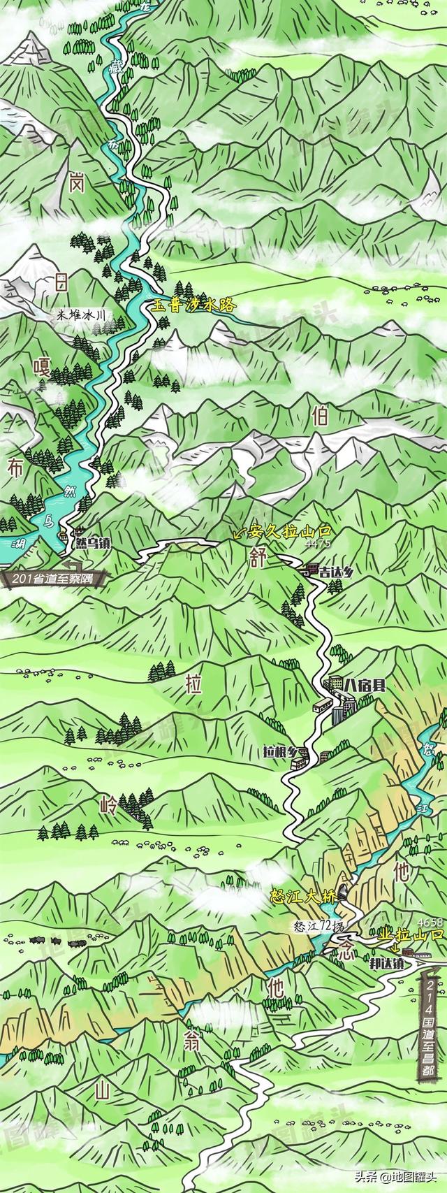
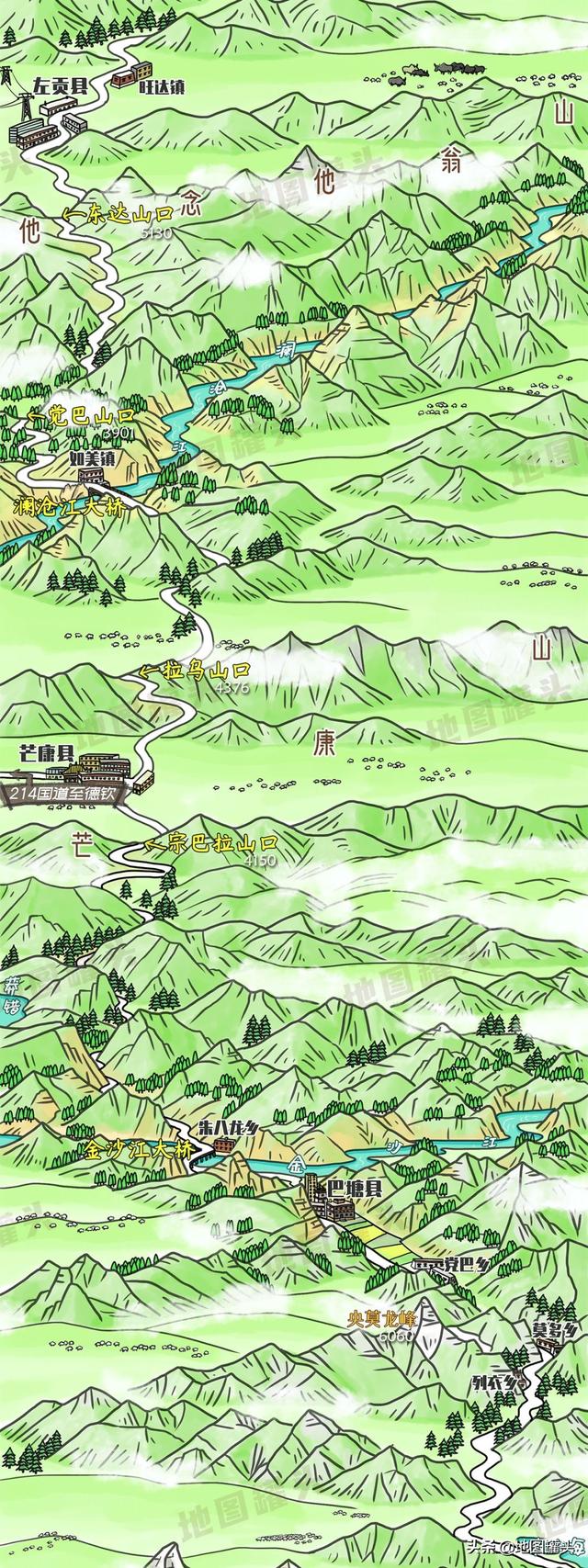
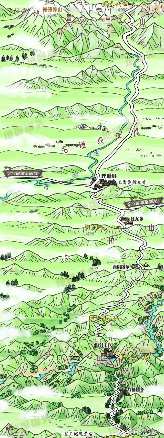
Although the Sichuan-Tibetan South Line is the easiest to travel on of the three Sichuan-Tibetan Highways, it still exists as a ‘road to heaven.’ Over the 2100+ kilometer horizontal expanse, travelers must traverse 14 passes with elevations above 4000 meters, cross seven major river systems, and pass through more than a dozen deep valleys to finally climb to Lhasa’s elevation of 3700 meters.
Although some passes have been constructed with tunnels, many people still choose to endure the difficult crossing of the old passes, experiencing the contrast of cold and heat, and the thrill of driving.
If you have traveled the Sichuan-Tibetan South Line, whether on foot, by self-driving, bicycle, or motorcycle, and you’ve seen scenes like these, they might evoke memories for you?
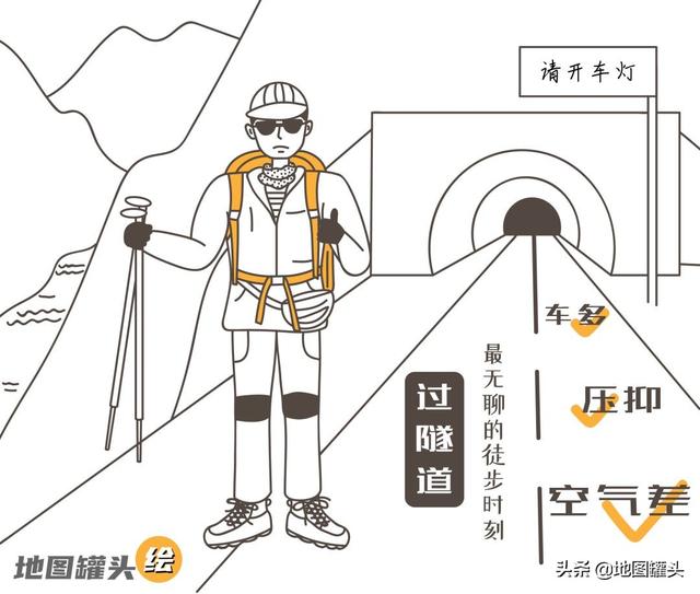
Most hikers on the Sichuan-Tibetan South Line eventually give up and switch to other forms of transportation.
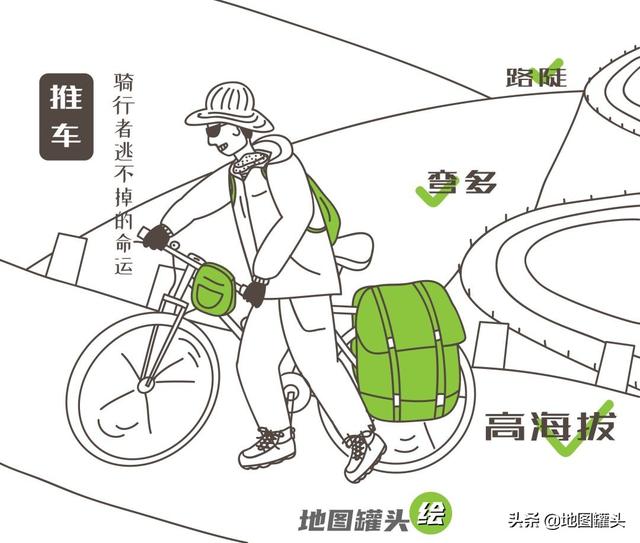
Most bicycle riders automatically switch to ‘decay mode’ after reaching Linzhi.
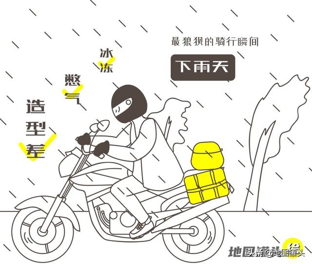
Motorcycle riders don’t mind crashing; they fear their GoPros falling off.
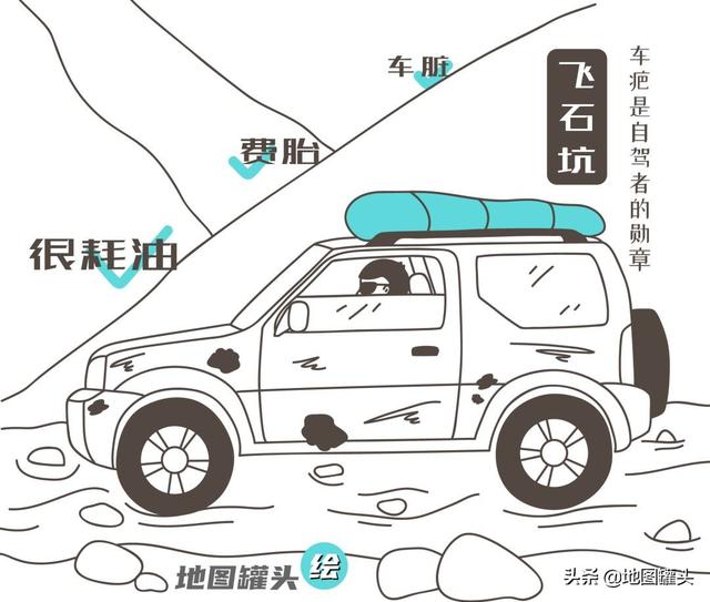
Most travelers throw away their luggage and return home, while self-driving drivers continue to drive their cars home.
Those who have traveled the Sichuan-Tibetan South Line know that this road doesn’t believe in tears or luck. Every turn of the steering wheel, every braking action, every acceleration, every ride against the wind, every step of pushing the car forward, even every thumbs-up, represents an unspoken contest between you and the Sichuan-Tibetan South Line.
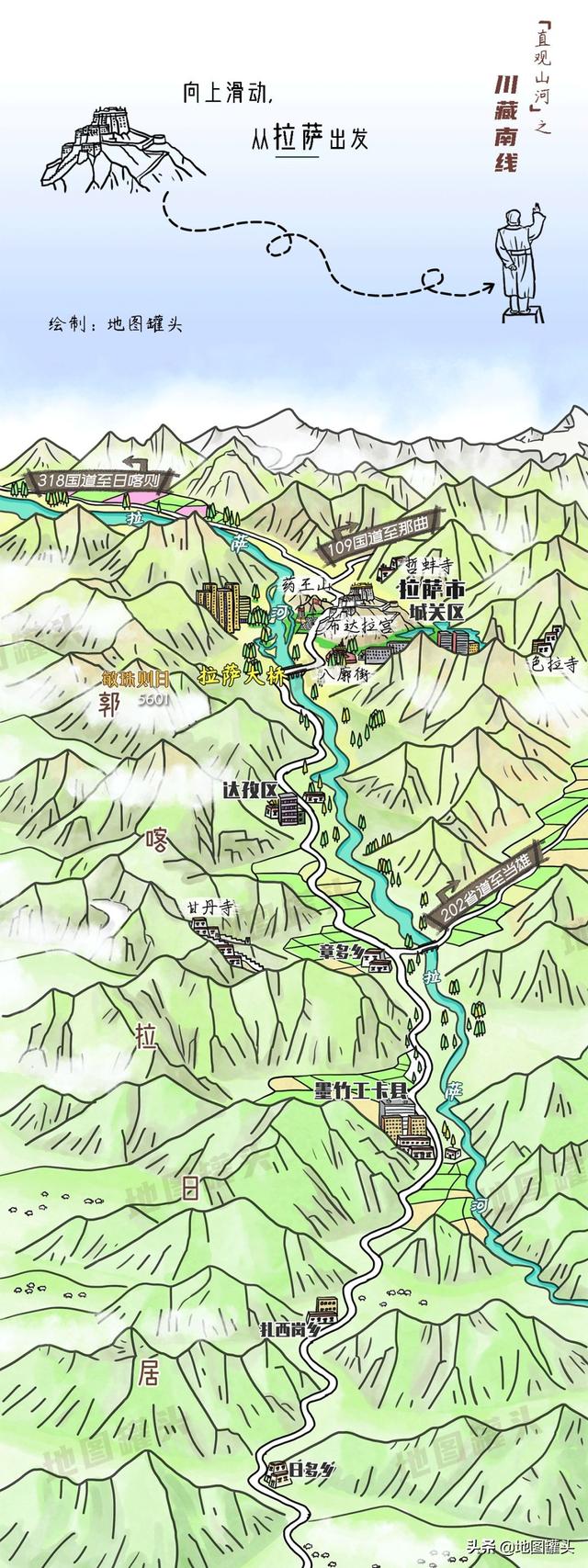
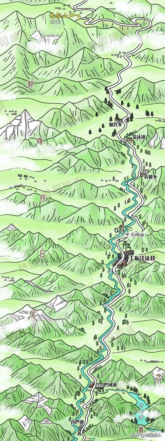
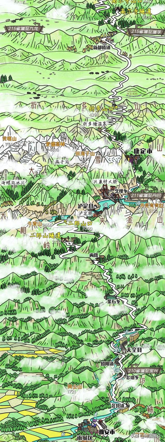
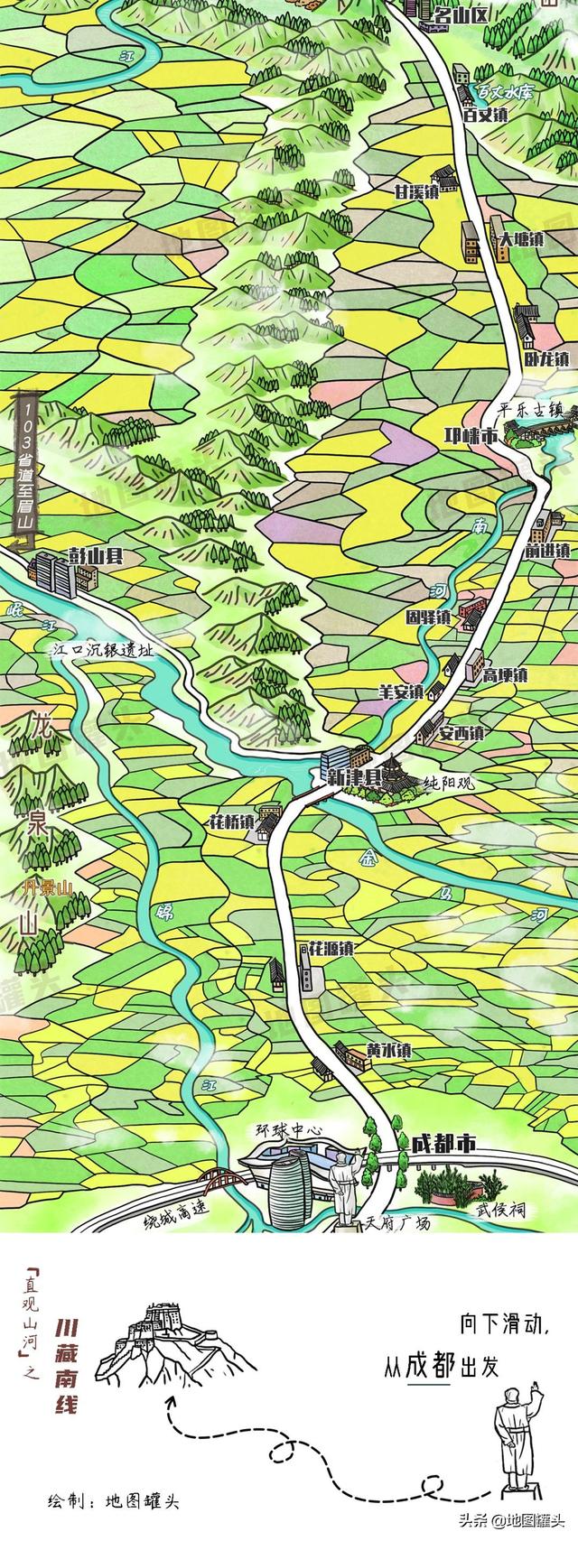
Let’s follow our hand-drawn map and take a look at the mountains and rivers of the Sichuan-Tibetan South Line.
–End–
All illustrations are original hand-drawn and cannot be used without permission.
▼ Scan the QR code to follow our WeChat account▼