Overview of Tourism in Xinjiang
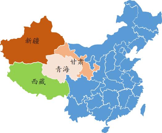
1. Regional Area:First, let's look at this map, which everyone should be familiar with – it's a map of China. On this map, I've highlighted Xinjiang in red with its square mileage, which is 1.66 million square kilometers. This represents 1/6 of China's total land area. Its area is equivalent to that of Henan, Shandong, Hebei, Beijing, Tianjin, Shanxi, Shaanxi, Hubei, Anhui, Jiangsu, Shanghai, Zhejiang, Hunan, and Sichuan – approximately 13 provinces. Even bigger than the combined area of three France (550,000 square kilometers). So, Xinjiang, in the northwest, is the largest part of China.
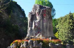
We understand a place through its history. Xinjiang was formerly known as ‘Xiyu’, which specifically refers to Xinjiang. The term ‘Xiyu’ was used until the mid-Qing dynasty. After the Qing government suppressed the Zhugan rebellion, Xiyu and the northern and southern regions of Tian Shan were divided into Xinjiang. The term ‘Xinjiang’ also has another meaning. In 1882, Russia was forced to return Ili. Tseng Tang felt a sense of returning to his homeland, so Xinjiang was designated as a province, meaning ‘returning to his homeland.’ Later, because Xinjiang was reclaimed from Russia, it was designated as a province.
2. Terrain Characteristics:The terrain characteristics of Xinjiang can be well summarized by one word: ‘Three Mountains and Two Basins.’ If you want to remember this quickly, just look at the ‘Xi’ () character in Xinjiang. It has three horizontal lines on its right half, with two ‘fields’ in the middle, representing Xinjiang’s terrain characteristics: ‘Three Mountains and Two Basins.’
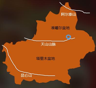
The basin between the Altay Mountains and Tian Shan is the Zhugan Basin. The basin between the Kunlun Mountains in the south and Tian Shan is called the Tarim Basin. And, with Tian Shan as the boundary, Xinjiang was divided into north and south Xinjiang – what we usually call North Xinjiang and South Xinjiang.