Self-Driving Xinjiang: Guozigou Bridge Panorama Shooting Location Guide - Aerial Footage Don't Miss It - Free Admission
Driving in Xinjiang is a truly rewarding experience, with countless breathtaking views along the way.
And many astonishing sights are free of charge.
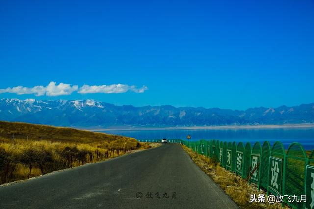
Located beside the famous scenic area of (Sailikule Lake), nicknamed 'The Last Tear of the Atlantic', is (Guozigou).
Guozigou is a remarkable gorge, approximately 28 kilometers long, with wild apple trees densely scattered throughout the mountains, hence its name.
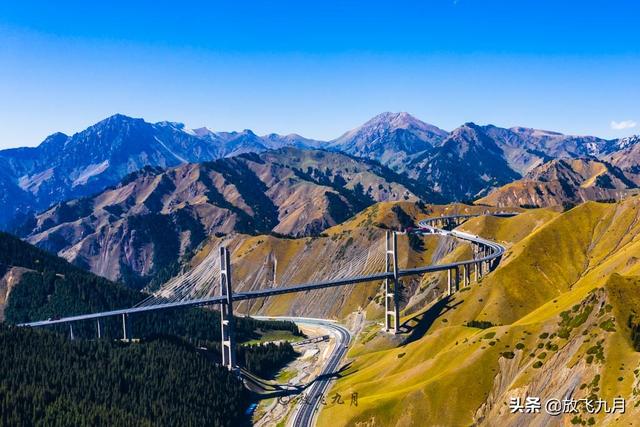
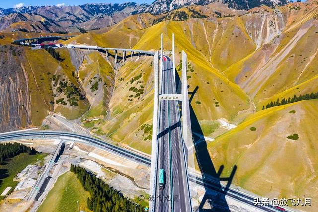
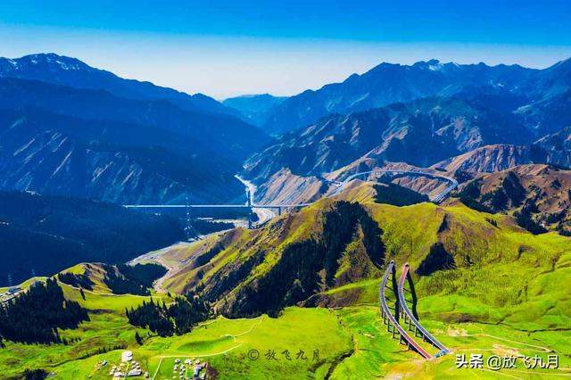
(Guozigou Bridge) is part of the G30 highway (from Lianyungang to Holguoshan), located across Guozigou Canyon, starting from Mongquler in the north and ending at the General Soldier Tunnel in the south, with a total length of 700 meters and a clearance of 200 meters. It's the first highway (tensile cable bridge) in Xinjiang and the first highway double-stay cable-supported steel truss cable-stayed bridge in mainland China.
In the morning, we drove from Holguoshan towards Sailikule Lake along the G30 highway.
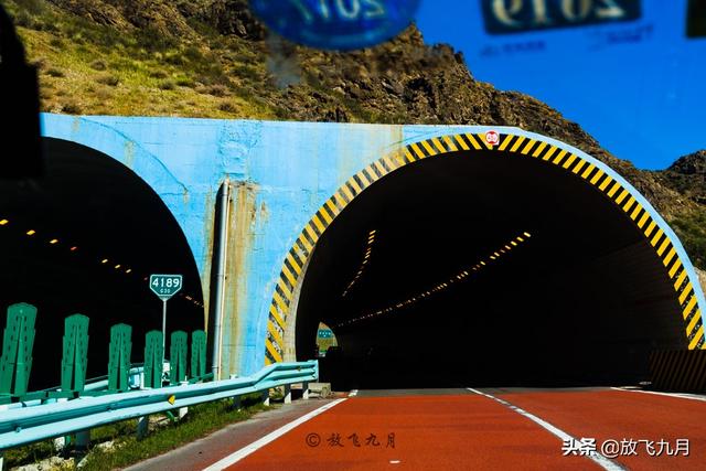
This highway has many beautiful sections along the way, and as we approached Sailikule Lake, there were several relatively short tunnels.
To go directly to Sailikule Lake, you can drive along the G30 highway until you reach the Sailikule Lake exit, and once you exit the highway, you'll arrive at the Sailikule Lake scenic area.
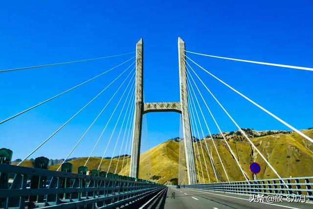
However, driving this way will directly pass through the Guozigou Bridge, as it's part of the G30 highway.
This means you can enjoy the magnificent spectacle of the Guozigou Bridge up close, but it's not conducive to capturing the panoramic view of the Guozigou Bridge, because you can't stop on the highway, let alone park on the bridge.
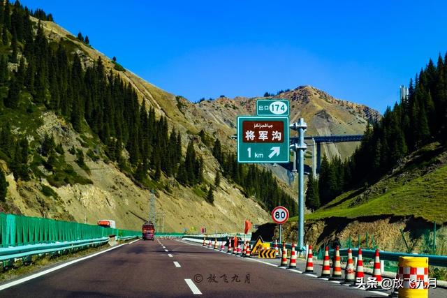
If you want to capture the panoramic view of the Guozigou Bridge, you can exit at a nearby exit – the General Soldier Exit – before reaching Sailikule Lake.
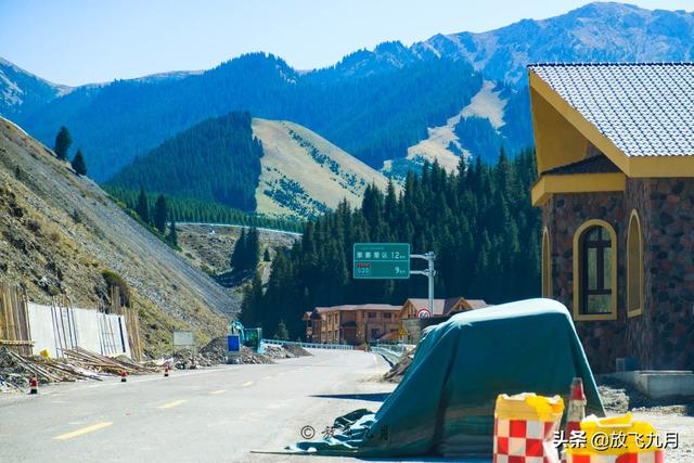
After exiting the highway, you'll only find one road to follow.
Initially, the road is lined with dismantled fences and garbage, a bit messy.
But as you see the signboard in the photo, the road conditions improve. This is 12 kilometers from Sailikule Lake and 9 kilometers from the other entrance of the G30 highway.
Continuing for about 10 kilometers on the mountain road, there are many parking areas, and they are all free.
Some parking areas are well-maintained and have neat, beautiful boardwalks to climb up and enjoy the view of the surrounding mountains, but you have to pay to enter.
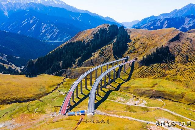
Many places can be flown over to capture the beautiful S-shaped view of the Guozigou Bridge.
This stunning bridge on the G30 highway looks like a giant dragon, winding and entering the mountains, leaving countless imaginations.
The other end of the Guozigou Bridge seems like a golden dragon spitting rainbows, with two beautiful curves emerging from the mountains and then entering another mountain.
The tunnels along the highway come from here.
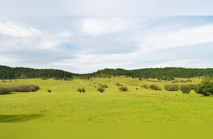
In summer, the Guozigou Bridge is covered in lush green grass, resembling a plush Persian carpet spread across the undulating mountains in the distance.
The Guozigou Bridge stretches across the sky, crossing through this green area.
(Turning a wasteland into a passage).
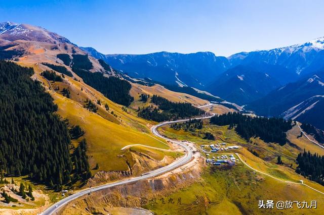
The winding mountain road flies past a series of mountains.
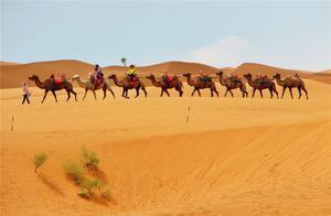
In Xinjiang, in all four seasons, there are different beautiful scenes with different charms.
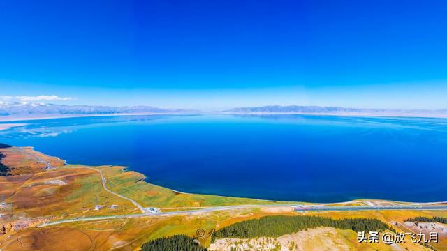
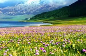
After flying from the Guozigou Bridge, you can easily take photos of Sailikule Lake, with a very good angle, which is better than the photos taken in the scenic area,
Because it's far away, you can capture the entire panoramic view of Sailikule Lake, which can't be taken in the scenic area.
4. This mountain road leads to the end and can connect to the G30 highway or enter the southern entrance of the Sailikule Lake scenic area. No matter how you go, pay attention to the oncoming traffic on the highway, because the speed is quite fast.
I am (Fàngfēi Jiǔyuè), who loves travel, photography, food, and beautiful scenery. Welcome to follow me, let's go see the world together!
This article's text and photos are all original. Please indicate the source when (copying and pasting).
1. 10
2. ""
3.
4.