The Most Comprehensive Free Electronic Map Software – 27 Categories, 106 Styles, Surely There’s One for You
When it comes to electronic maps, many people are familiar with Baidu and Gaode, which are essential for daily shopping. Google Earth is a favorite among researchers and explorers.
There are countless electronic map browsing software available online, but has any software managed to include all the common map services?
Today, the editor recommends a very easy to use and powerful map browsing software,'Meigu Tu'
This software is practical for researchers, students, teachers, explorers, designers, and engineers. Let's take a look at its strengths below.
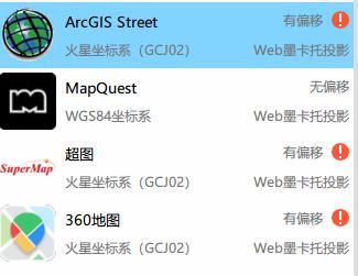
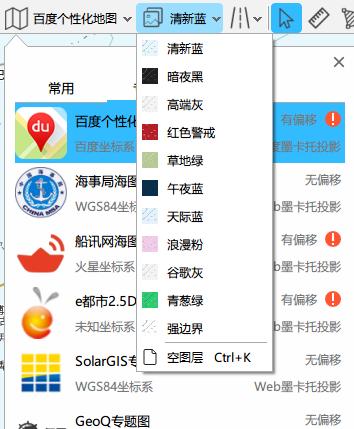
1. The most comprehensive map resources
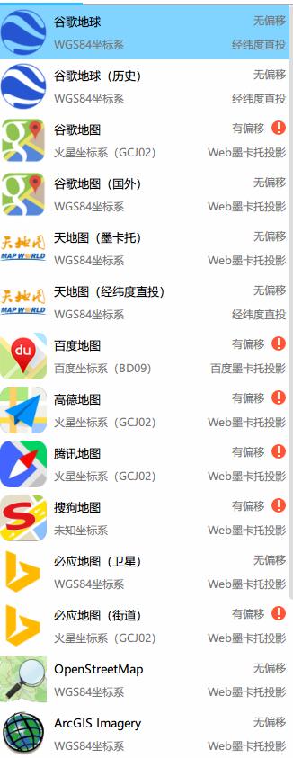
According to the editor's incomplete statistics, Meigu Tu supports more than 27 categories and over 106 styles or subtypes of maps. It can be said that it has the most complete maps on the entire network.
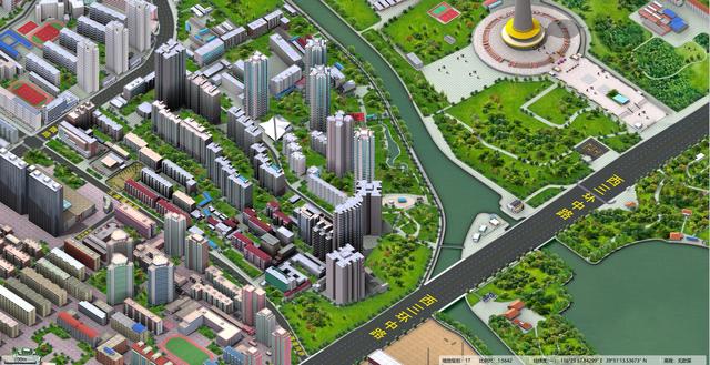
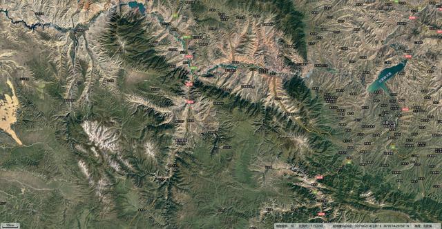
2. High-quality map display
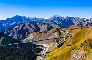
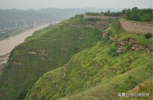
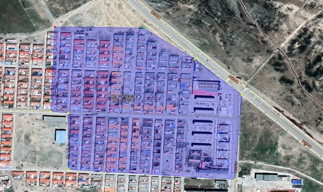
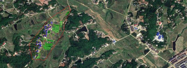
Meigu Tu's collected map resources are of high quality and have excellent display effects. Even Google satellite maps display faster than other similar software, with a faster speed.
3. Rich supporting tools
Supports area calculation.
- Supports distance calculation.
- Supports profile generation and display.
- Supports professional calibration, including four-parameter and seven-parameter precise alignment.
- POI search, positioning, element annotation, high-definition printing screenshots.
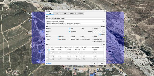
- 4. Support ultra-fast download
- See is believe, almost all maps support download, output various software formats, support high-definition large picture splicing.
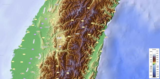
- 5. Extremely professional
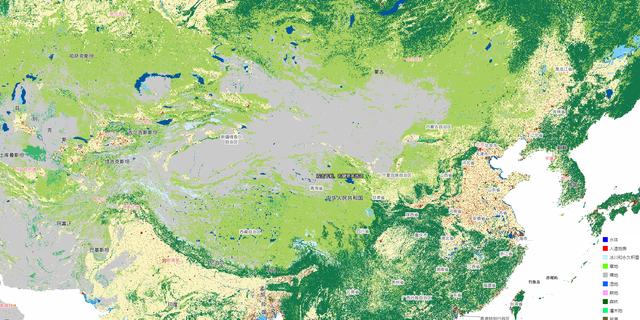
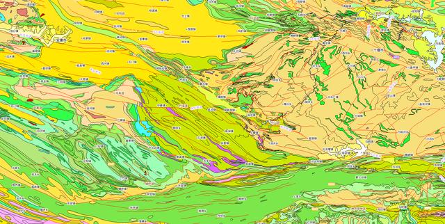
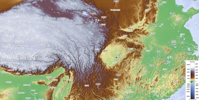
Geological maps, vegetation maps, marine maps, topographic maps, temperature maps, radiation maps, population thematic maps, landscape thematic maps, district maps, river maps, surface coverage maps... Too many, the editor feels a little dizzy, haha.
Surface Coverage Maps
Geological Maps
Topographic Maps
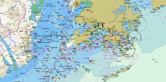
Marine Maps
In short, if you need a full-featured electronic map software, this one is enough.
Quickly collect it, don't forget it when you need it. Follow me to share daily practical technical dry goods.